
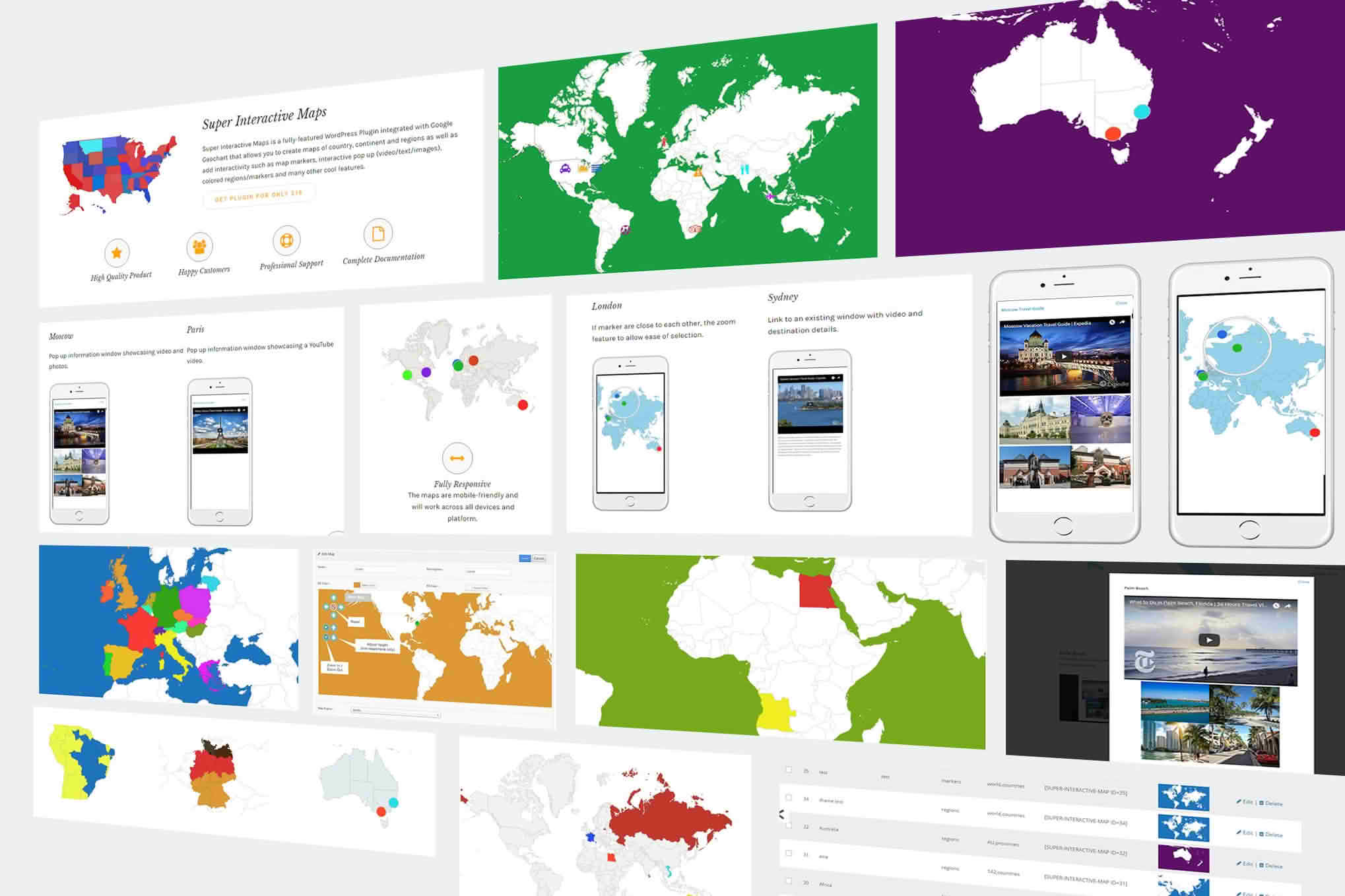
Super Interactive Maps transforms static, boring geographical data into engaging, dynamic visual experiences for your WordPress website. Designed for businesses, travel bloggers, and data-driven organizations, this plugin allows you to create highly customizable, responsive, and clickable maps that captivate your visitors. Whether you need to showcase store locations, track delivery routes, or visualize complex regional statistics, Super Interactive Maps provides the intuitive tools necessary to turn your site into an immersive, information-rich platform.
Key Features
- Fully Responsive Design: Your maps will look perfect and function flawlessly on all devices, including desktops, tablets, and smartphones, ensuring a consistent user experience regardless of screen size.
- Extensive Map Library: Access a vast collection of pre-built maps, including world maps, continents, individual countries, and even specific regions or states, providing you with the granular control needed for your project.
- Interactive Elements: Enhance engagement by adding tooltips, popups, and click actions to specific regions or markers, allowing users to discover more information simply by hovering over or clicking on areas of interest.
- Customizable Styling: Match your brand identity effortlessly by customizing colors, borders, hover effects, and zoom levels, ensuring the map integrates seamlessly with your existing website design.
- Marker and Pin Functionality: Easily drop custom markers or pins onto your map to highlight specific locations, such as physical offices, project sites, or points of interest, complete with custom icons and labels.
- Data Visualization: Utilize color-coding features to represent different data sets visually, making it easy for your audience to understand trends, sales performance, or demographic information at a glance.
- Easy Integration: Deploy your maps anywhere on your site using simple shortcodes, making it compatible with all major page builders and standard WordPress editor blocks.
Use Cases and Who It’s For
Super Interactive Maps is the ideal solution for anyone looking to communicate location-based information effectively. Retailers and franchise owners use the plugin to build store locators, helping customers find the nearest branch in seconds. Travel agencies and bloggers leverage the interactive nature of the maps to showcase itineraries, highlight visited countries, or provide visual guides for popular destinations.
Additionally, the plugin is a powerful tool for news organizations and research institutions that need to present statistical data in a digestible format. By transforming raw numbers into an interactive visual, you can tell more compelling stories and help your audience grasp complex geographical trends without overwhelming them with text or spreadsheets.
Setup and How It Works
Getting started with Super Interactive Maps is designed to be a straightforward process that requires no coding knowledge:
- Installation: Upload and activate the plugin through your WordPress dashboard just like any other standard plugin.
- Select Your Map: Navigate to the plugin settings and choose the geographical area you wish to display from the comprehensive built-in library.
- Customize Appearance: Use the intuitive visual editor to adjust colors, hover behaviors, and zoom constraints to match your website’s aesthetic.
- Add Data: Define your markers, popups, or regional color-coding rules based on the specific information you want to communicate.
- Publish: Copy the generated shortcode and paste it into any page, post, or widget area to bring your interactive map to life.
Similar Plugins
If you are exploring alternatives in the WordPress ecosystem, other notable solutions include MapPress Maps for WordPress, which excels in Google Maps integration, and Interactive Geo Maps, which offers a similar focus on vector-based, customizable regional maps.